Center for Geospatial Information Technology helps Virginia update its flood maps
A team of floodplain specialists from the Center for Geospatial Information Technology (CGIT) at Virginia Tech has been coordinating a statewide project designed to manage the efforts of 280 local communities to bring their flood maps up-to-date.
New and accurate flood maps provide valuable information about flood risk areas to home and business owners, developers, and flood insurance companies. Three years into the five year project, the center has collected information from almost half of the 115 Virginia communities that need their flood maps updated. CGIT will also survey the remaining 165 communities where map modernization is currently underway or where flood maps have already been revised by various state or private contractors.
The Map Modernization Management Support (MMMS) initiative was created in 2003 by the Federal Emergency Management Agency (FEMA). The commonwealth’s portion of the national project is administered by the Virginia Department of Conservation and Recreation.
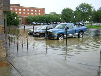
According to the National Weather Service, flash flooding and river flooding are the deadliest weather-related disasters in Virginia. The Virginia Department of Emergency Management lists 35 presidentially declared weather-related disasters in Virginia since 1969, of which almost three in four were floods. However, according to FEMA, costly damage to homes and businesses can be caused by as little as one inch of water, not just by heavy rushing flood waters.
By updating the current flood maps with the newest flood risk information, the devastating consequences of flooding can be limited and even prevented.
“The flood map modernization project was created to transform the existing, often outdated flood maps into more reliable and easy to use tools,” said Randy Dymond, associate director at CGIT and associate professor of civil and environmental engineering at Virginia Tech. “For example, the new maps will determine the areas in which to build safely, and will allow homeowners to buy flood insurance based on actual risk.”
The Center for Geospatial Information Technology has been involved in the Virginia Map Modernization Management Support since 2004.
“During the first year of our involvement in this project, we created a five-year plan for developing the updated flood hazard information and maps. More recently, we have created an informative website for the public about floodplain map modernization, and a local up-to-date floodplain contact database,” said Rachael Heltz Herman, the environmental GIS manager at CGIT.
The website also includes an online survey for local floodplain administrators throughout the commonwealth who are invited to provide information on floodplain mapping-related topics. Such issues include damage estimates from recent floods or areas in the community experiencing the most pressure from urban development.
“We are now expanding the web site further and will initiate additional contacts with the communities that have already gone through flood map modernization as well as those that are scheduled in the future,” said Herman.
The updated and modernized flood maps will also be used to create Digital Flood Insurance Rate Maps (DFIRMs) for more than 20,000 communities across the U.S, including Virginia. DFIRMs are special maps on which FEMA has delineated the flood-prone areas along with the corresponding flood insurance premiums.
The Center for Geospatial Information Technology at Virginia Tech is a dual-campus, interdisciplinary research center that specializes in cutting-edge geospatial data analysis and applications. The center’s staff and affiliated faculty members provide expertise in a variety of areas, such as infrastructure and transportation, natural resource and hazard mitigation planning, environmental management, homeland security, wireless communications, and public health.