


Geospatial education project works to bring drone technology to Virginia’s community colleges
Thanks to a grant from the National Science Foundation’s Advanced Technological Education program, the Geospatial Technician Education-Unmanned Aircraft Systems project is one step closer to offering Virginia’s community college students training on operating small unmanned aircraft, commonly referred to as drones.
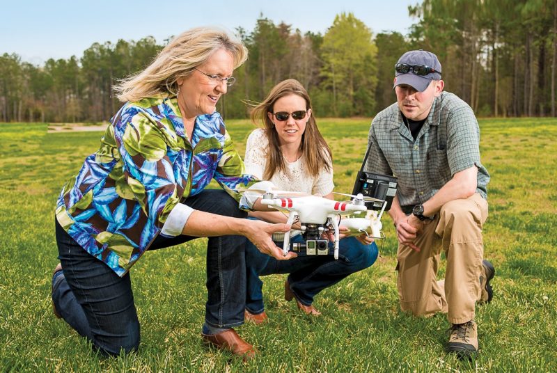
John McGee, professor in Virginia Tech’s College of Natural Resources and Environment and Virginia Cooperative Extension geospatial specialist, has worked alongside the Virginia Space Grant Consortium and the Virginia Community College System on expanding geospatial technician education at the community college level for almost nine years. Emerging technology has led to changing goals for the organization.
“Unmanned aircraft are facilitating data acquisition efforts. These aircraft are transforming how industries do business,” McGee said. “There’s a lot of activity in this field in Virginia already. We want to make sure that Virginia’s workforce is well poised to meet emerging industry needs.”
Small unmanned aircraft systems (sUAS) can be outfitted with a variety of cameras and sensors depending on the specific data researchers seek to collect. In addition to providing incredibly diverse sets of data, these aircraft can cover hundreds of acres in a 45-minute flight.
According to McGee, the possible industrial uses for drones are practically endless.
“They can be used for wildlife habitat mapping, for public safety, to support land-use management, or to aid in precision farming,” he said. “They could even be used to inspect bridges and transmission lines and take away the human risk from those types of inspections.”
To ensure that Virginia’s community college students have the knowledge and skills necessary to utilize this expanding technology, McGee and the Virginia Space Grant Consortium have partnered with faculty from Thomas Nelson, Mountain Empire, and John Tyler community colleges to develop a curriculum chart that will help community college instructors establish courses that will benefit students.
McGee said the project seeks to provide students with a range of options, from individual courses to various levels of certificate programs.
McGee recently led the effort to develop a curriculum chart by bringing together a focus group of professional sUAS technicians and technician managers. McGee and his colleagues learned about their day-to-day responsibilities and developed a list of their crucial tasks and duties, which will inform the development of components for a successful curriculum.
The curriculum chart maps the skills and knowledge that students will need into categories like flight planning, maintenance, and safety. Based on the chart, educators can begin to develop course objectives and goals that will shape how various courses are organized.
“We’re providing educators with a curriculum roadmap that they can use to enhance existing courses, create new courses, and support sUAS certificate programs,” McGee explained. “These courses and programs will be a natural fit for students entering an array of industries, including natural resources conservation, agricultural technology, engineering, public safety, computer programming, and information technology.”
McGee expects that students could see sUAS courses in Virginia's community college system within the next year.
According to Cherie Aukland, associate professor of information technology at Thomas Nelson Community College, courses will focus on helping the students develop the skills necessary to maintain and pilot devices safely, use and analyze data from a variety of sensors, and pass the Federal Aviation Administration’s remote pilot certificate exam.
“There is a lot going on with drones in Virginia right now, and more jobs are on the way,” Aukland explained. “We want to be able to train technicians who can finish their training and transition immediately into the workforce.”
Until late August, the Federal Aviation Administration required that sUAS operators have a pilot’s license, but new regulations have paved the way for others to pilot the aircrafts. That makes now the ideal time to introduce the technology into Virginia’s community colleges, McGee said.
According to Chris Carter, deputy director of the Virginia Space Grant Consortium, the sUAS curriculum chart is only the first step in the latest Geospatial Technician Education initiative.
During summer 2017, Virginia Tech will host a weeklong professional development session for community college faculty who are interested in teaching sUAS courses. These faculty will team up with mentors from the Geospatial Technician Education project to learn the best ways to teach sUAS courses to their students.
“The Virginia Community College System serves as a pipeline for the workforce and for universities. It’s in everyone’s best interest to support these community colleges,” Carter said.


