


Camera-trap research paves the way for global monitoring networks
Biodiversity loss is one of the driving factors in ecosystem change, on par with climate change and human development. When one species, especially a large predator, disappears from an area, other populations will be affected, sometimes changing entire landscapes.
In recent years, there have been numerous calls for coordinated global monitoring networks to understand and mitigate the effects of ecosystem change and biodiversity loss around the world. A new study led by Lindsey Rich, who recently completed her doctorate in wildlife conservation in Virginia Tech’s College of Natural Resources and Environment, demonstrates that camera traps are one of the most effective methods of collecting this type of data.
The study was published online in Global Ecology and Biogeography.
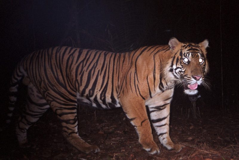
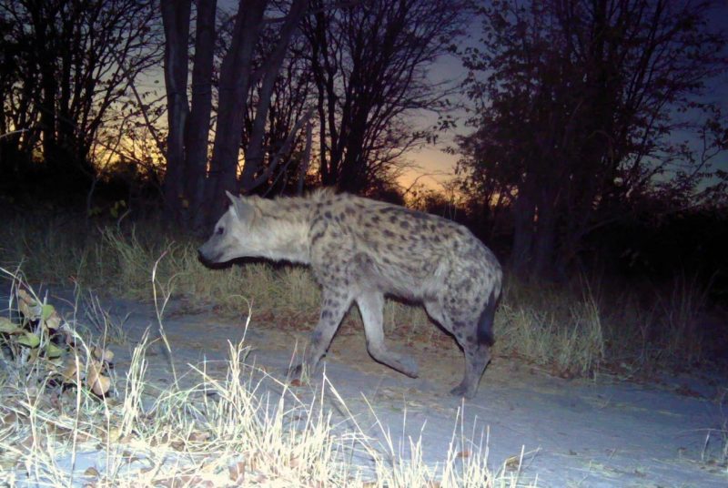
Rich, along with researchers from universities, government agencies, and nonprofit organizations all over the world, compiled camera-trap data from 12 countries to evaluate the interchange between fine- and broad-scale processes impacting 96 species of mammalian carnivores, ranging from Arctic foxes to Sumatran tigers.
To begin the project, Rich reached out to national and international colleagues who were working on camera-trap research, including Marcella Kelly, professor in Virginia Tech’s Department of Fish and Wildlife Conservation, and five of Kelly’s former graduate students: Zach Farris, S. Sunarto, Kanchan Thapa, Mamadou Kane, and Claudia Wultsch.
Camera traps, which are usually attached to trees or metal fence posts, allow researchers to collect data 24 hours a day in all weather conditions. They rely on motion- and heat-sensing technology to detect passing animals and then generate time- and date-stamped photographs.
Each researcher submitted camera-trap data collected during previous studies, along with a standardized data sheet including information from each specific project.
“That’s the strength of camera-trap data,” Rich said. “It can be used to address multiple questions at multiple spatial scales, and doesn’t just have to be shelved after a single project.”
Once Rich had collected data from each researcher, she worked with doctoral candidate Courtney Davis and Assistant Professor David Miller of the Department of Ecosystem Science and Management at Penn State University to analyze and compile the data.
“The initial stages can be a labor-intensive process, because you might be working with tens or hundreds of thousands of images, and you have to go through each and classify it based on the species photographed,” Rich explained.
Once the data was compiled, the researchers were able to use an occupancy modeling framework to estimate the probability that a particular carnivore species occupied each area, and how these species were affected by the availability of prey, habitat characteristics, and human influence.
Rich discovered that her research supported the ecological principle that despite differences in landscape and geographic region, prey availability can fundamentally determine carnivore distributions. The research also affirmed the notion that carnivore populations are affected by human development and influence.
“Globally and for the majority of study areas, carnivores were more likely to occupy areas with greater prey resources,” she said. “We also found that globally and for several specific study areas, carnivores were more likely to occupy protected areas, such as national parks, that were further from major roads.”
Rich noted that the study incorporates diverse design methods and that fine-scale information about landscapes and human development wasn’t readily available for every region represented in the study.
In the future, she explained, a global network collecting similar data will want to standardize camera-trap field methodologies to improve inferences, ensure that those inferences are reflective of the landscape, and allow researchers to look at species changes over long periods of time.
“We used the best spatial resolution data available at the time, but as information on vegetation, water availability, and human development becomes available at finer resolutions and broader spatial scales, other researchers conducting similar studies should take advantage of it,” said Rich, who is currently a post-doctoral researcher at the University of California, Berkeley.
Despite some limitations on the study, Rich is encouraged by the ease of bringing together so many collaborators from across the globe.
“All of the co-authors were incredibly receptive to contributing their data, including those I’d never worked with in the past,” she said. “Working together to build this collaborative effort was exciting, and it demonstrates that this type of effort can be achieved. Being able to bring together vast amounts of data in a global network will allow us to ask new questions and provide information at a pace necessary to keep up with policy and management decisions to address major environmental challenges in the future.”


